Most countries have a coastline. South Africa has two oceans. That distinction matters more than it might initially seem, because the Atlantic and Indian Oceans that flank this country are genuinely different bodies of water — different temperatures, different marine ecosystems, different moods, and different experiences for anyone who travels between them. Understanding that difference is one of the most useful things you can know before planning a trip here.
The Atlantic coast: cold, dramatic, and unlike anything you expect
The Atlantic seaboard runs up the western edge of South Africa, from the Cape Peninsula northward through Namibia. It is fed by the Benguela Current, a cold upwelling from the deep South Atlantic that keeps water temperatures between 10 and 16°C even in midsummer. You do not swim in the Atlantic here — or rather, you can, but only briefly, and with the specific glee of someone who has accepted discomfort as part of the experience.
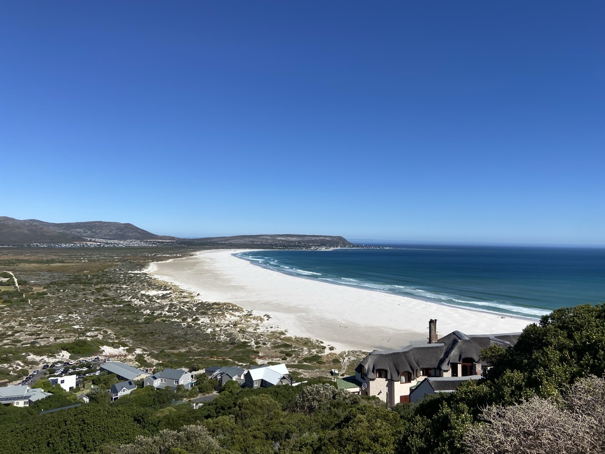
What the Atlantic offers instead is drama. The beaches along this coast are vast and often deserted — Noordhoek, Scarborough, the long sweep of Hout Bay — backed by mountains that drop almost directly into the sea. The light is extraordinary, particularly in the late afternoon when it comes in low off the water and turns everything amber. It is not a coast for lounging. It is a coast for walking, for watching, for feeling very small against something very large.
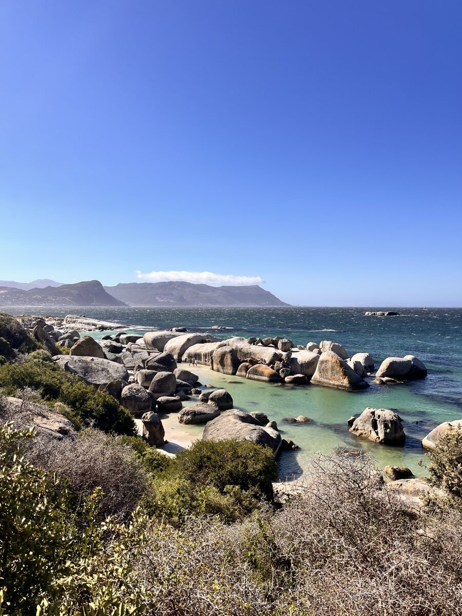
There are exceptions to the cold. The sheltered coves of the Cape Peninsula — particularly around Simon’s Town and Fish Hoek — are protected enough from the swell that the water warms slightly and the swimming becomes genuinely pleasant. Boulders Beach, tucked between granite outcrops south of Simon’s Town, is one of those rare places where the ocean feels both wild and approachable — and where African penguins have decided to make their permanent home in the thousands.
Where the oceans meet: the Garden Route
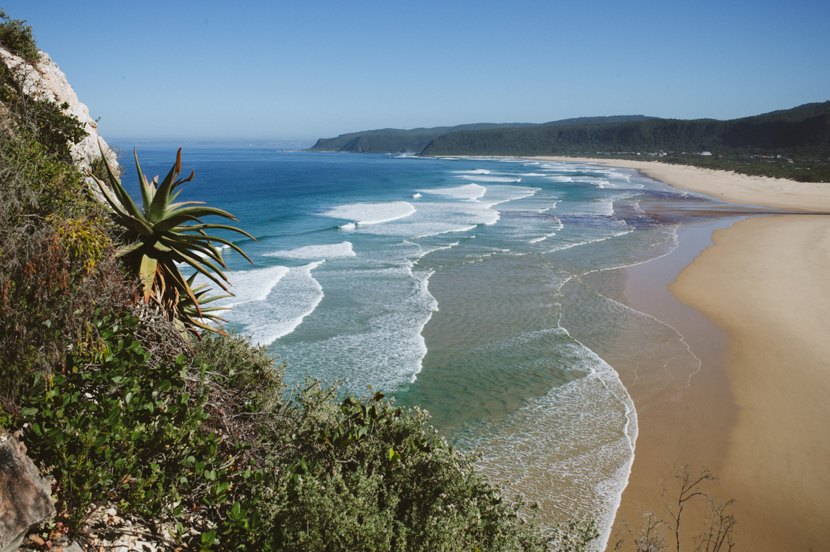
The two oceans meet — technically, oceanographically — at Cape Agulhas, the southernmost point of the African continent. But for anyone travelling the coast, the transition is felt most clearly along the Garden Route: the stretch of coastline running from Mossel Bay east to Storms River that sits at the boundary where Atlantic influence gives way to the warmer waters of the Indian Ocean.
The water temperature rises. The vegetation thickens. The lagoons become wider, calmer, greener. The landscape shifts from the spare drama of the Cape Peninsula to something more lush and enclosed — indigenous forest running down to the sea, rivers emptying into broad estuaries, cliffs giving way to long curved bays where the surf arrives in clean, regular lines.
The Garden Route is South Africa’s most famous coastal drive, and for good reason — but the reason is not simply scenery. It is that this stretch of coast captures the transition between two completely different ocean systems within a single journey, which makes it unlike any other coastal drive on the continent.
The Indian Ocean: warm, subtropical, unhurried
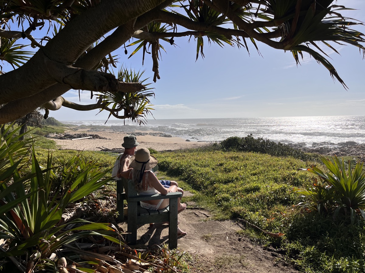
East of the Garden Route, the Indian Ocean takes over entirely. By the time you reach KwaZulu-Natal, the water is genuinely warm — hovering around 22 to 26°C in summer — and the coastline has a subtropical character that feels closer to East Africa than to the Cape. The vegetation is dense, the beaches are wide and golden, and the pace of life slows in the way that only genuinely warm coastlines seem to permit.
The KwaZulu-Natal coast is South Africa’s swimming coast. Families have been coming here for generations — to Ballito, to Umhlanga, to the Bluff south of Durban — for the specific pleasure of an ocean that welcomes you rather than challenges you. The towns along this coast are unpretentious and comfortable, built around the rhythm of the tides and the school holidays that fill them each year.
Maputaland: the wild northern edge
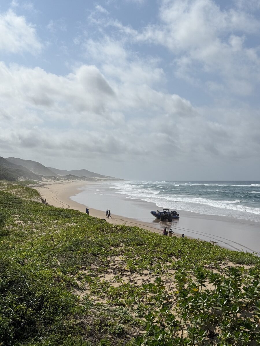
Continue north of St Lucia and the coast changes character again — this time into something genuinely remote. Maputaland, the stretch of coastline running up to the Mozambican border, is one of the last truly wild sections of South African coast: no development, no infrastructure, barely any access. The beaches here run for kilometres without a footprint, the dunes rise steeply behind them, and the Indian Ocean arrives with the full energy of open water that has travelled uninterrupted from Madagascar.
What makes Maputaland exceptional is what happens beneath the surface. The Sodwana Bay reef system is one of the southernmost coral reefs in the world, home to whale sharks, manta rays, and reef fish in extraordinary density. Between November and January, leatherback and loggerhead turtles come ashore at night to nest on these beaches — an ancient ritual that has been happening here for millions of years and that a very small number of visitors are permitted to witness each season.
Getting to Maputaland takes planning. The roads are often sandy, the accommodation is limited and books out far in advance, and the turtle excursions are managed by conservation authorities who restrict numbers tightly. This is precisely why it remains what it is: one of the few sections of African coastline where the ocean still has the upper hand.
Why it matters for how you plan
The practical consequence of all this is that South Africa’s coast cannot be experienced as a single entity. A week in Cape Town gives you the Atlantic — cold, dramatic, theatrical. A week on the KZN coast gives you the Indian Ocean — warm, easy, subtropical. The Garden Route connects them. Maputaland is something else again.
If you want to swim, you need the east. If you want dramatic scenery within reach of a city, you need the west. If you want marine wildlife at its most extraordinary, you need the north. None of these coasts is interchangeable with the others — and understanding that is the starting point for building an itinerary that actually delivers what you came for.